Sunday, February 9, 2020

10 Places You Must Visit in Tiruchirappalli

Tiruchirappalli is a busy city in Tamil Nadu, a state in South India. More than 900,000 people live in this Indian city, which covers an area of around 167.23 square kilometers.
Tiruchirappalli is located on the plains between the Shevaroy Hills to the north and the Palni Hills. It has a tropical savanna climate. Average temperature is 28.9 °C.

How to Reach Tiruchirappalli

Tiruchirappalli is well-connected by air, rail and road. The city has an ISO 9001:2008 quality certified international airport, the Tiruchirappalli International Airport. The Tiruchirappalli Junction railway station is located in Rockins Road. Chatram Bus Stand and the Central Bus Stand are the two major bus stations in the city.

Hotels in Tiruchirappalli

4-Star Hotels
3-Star Hotels
2-Star Hotels
1-Star Hotels
Lakshmi Hotel
Sangam Hotel
Hotel Shri Swarna's Palace
Hotel High Point
Breeze Residency
Alam Residency
Hotel Raks
Grand Gardenia
Hotel Sona's

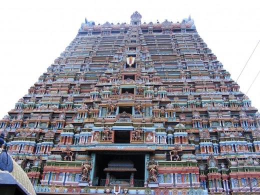
Sri Ranganathaswamy Temple

This temple is located in Srirangam, an island that is part of Tiruchirapalli. It is also known as Thiruvarangam. It is dedicated to Sri Ranganathaswamy, the reclining form of Lord Vishnu.
Sri Ranganathaswamy Temple is the foremost of the eight self-manifested shrines (Swayam Vyakta Kshetras) of Lord Vishnu. The Rajagopuram is 73 meters high. Built in the Dravidian style of architecture, the Temple Complex is massive in scale and covers around 156 acres.
Timings:
The temple is open daily.
6.00 am - 7.15 am (Viswaroopa Seva)
9.00 am - 12.00 pm
1.15 pm - 6.00 pm
6.45 pm - 9.00 pm
Wikimedia Commons
Wikimedia Commons

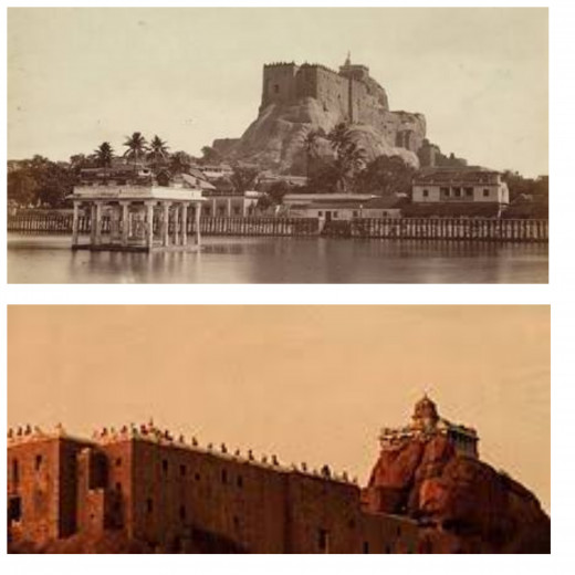
Tiruchirapalli Rock Fort

Built on a 83-metre-high rock, this fort houses two Hindu temples: the Ucchi Pillayar Temple and the Thayumanaswami Temple.

Trichy Rockfort Images

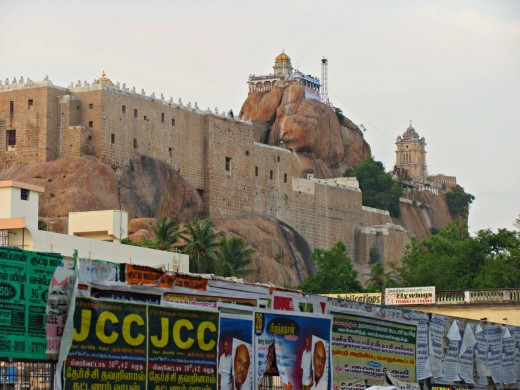
Ucchi Pillayar Temple

Located on top of Rockfort, this 7th-century Hindu temple is dedicated to Lord Ganapathi. Views are superb from the top of the massive outcrop (273 feet high); with eagles wheeling beneath and Trichy sprawling all around.
Wikimedia Commons
Wikimedia Commons | 

Ucchi Pillayar Temple Timings

Opening
Closing
6.00 am
8.00 pm

Kallanai Dam

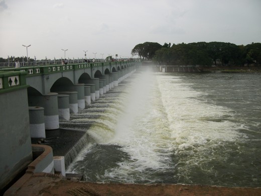
Located around 15 kilometers from Tiruchirapalli, this ancient dam was built across River Kaveri with uneven stones. It was built in the second century by Chola King Karikalan.
The purpose of constructing this composite dam and reservoir was to divert the waters of River Kaveri to Thanjavur for irrigation. Kallanai Dam is a classic example of engineering marvel of ancient India.
Kallanai Dam is 329 meters long and 20 meters wide. It is in excellent condition and used as a major irrigation dam. It is also known as Grand Anicut Dam.
Wikimedia Commons
Wikimedia Commons | Source

Kallanai Dam Timings

10.00 am to 6.00 pm.

Sri Ayyappan Temple

Located in Lawsons Road, this temple is famous for the 50-ft-tall statue of Lord Ayyappan.
Cleanliness and silence in the temple premises will delight you. This wonderful place of worship welcomes all human beings, irrespective of their religion, color, race, sex, language, status, property and birth.

Ayyappa Temple Timings

Opening
Closing
5.00 am
11.00 am
5.00 pm
8.30 pm

Puliyancholai Falls

Located around 76 kilometers from Tiruchirappalli, the Puliancholai falls is a terrace waterfall.
It is on the foothills of Kolli Hills. It is surrounded by lush green forest. The stillness is livened by the groups of people jumping in the stream for occasional dips. This region a trekker's paradise. It also houses many medicinal plants. People from far and near come and take a bath to get rid of their diseases.

Mukkombu

Mukkombu , which is also known as Upper Anaicut, is a 685-meter-long dam built on River Kaveri. Located around 18 kilometers from Trichirappalli, this beautiful picnic spot is well-known for its verdant green landscape. It has an amusement park, science park, boating, children’s garden, sports facilities, toy train, fishing facilities and more.
The pleasant breeze and nice atmosphere makes this an ideal picnic spot.
— Sharmila Thangapandi

Jambukeswarar Temple

This Shiva temple is located in Sannathi Street, Thiruvanaikoil, Srirangam. This 1,800 year old temple was built by Chola king Kocengannan. It is a good example of Dravidian architecture. The temple is open from 5.30 am. to 1.00 pm; and from 3.00 pm. to 8.30 pm.

Heartfulness Meditation Center

Located in K. K. Nagar, this meditation center enables you to experience the spiritual side of Tiruchirappalli. Here you can learn techniques to relax, rejuvenate and evolve. I liked the hospitality of the people here.

Samayapuram Mariamman Temple

This temple is located in Maruthur Road. It is dedicated to Samayapurathal, a form of Aadi Shakti. Since the diety is made of sand and clay there are no abhishekams on it.

Friday, February 7, 2020

7 Major Tourist Attractions in Konark

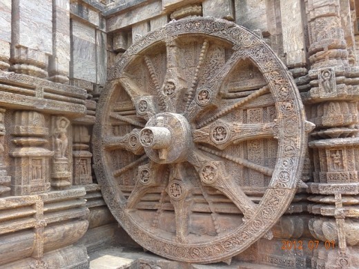
Intricate Stone Wheel Carving at the Sun Temple in Konark


Source

Konark is a town in Puri district in Odisha, a state in East India. It is located on the coast of the Bay of Bengal.
There is something about Konark that sets it apart from the rest. It takes you on a journey of ambrosial food and transports you to the land of divine. Its culture echoes the past but resonates with the current generation at the same time. Around 17,000 people live in Konark.

How to Reach Konark?

Biju Patnaik International Airport is the nearest airport to Konark; it is around 61 kilometers from Konark. It is linked with cities like Kolkata, Delhi, Hyderabad, Chennai, Bangalore and Nagpur.
Puri Railway Station is the nearest railway station; it is around 31 kilometers from Konark. Konark is well-connected by road to various cities and towns in the region.

Hotels in Konark

Surya Inn
Labanya Lodge
Sun Temple Hotel
Yatrinivas

Sun Temple

This beautiful 13th-century temple is built in Kalinga architecture. It was built by king Narasimhadeva I of Eastern Ganga Dynasty. This colossal temple is dedicated to Sun God.
This masterpiece was designed in the form of a chariot mounted on 24 wheels and drawn by seven horses; it is a chariot for the Sun God. The diameter of each wheel is around 10 feet.
The Sun Temple is directly associated with the idea and belief of the personification of the Sun God, which is adumbrated in the Vedas and classical texts.
You will find exquisite stone carvings in this magnificent Hindu temple, which has been a UNESCO World Heritage Site since 1984. It is a stunning monument of religious significance. It is also known as Konark temple.

Konark Temple Mystery

The cause of the destruction of the Konark temple is unclear and remains a source of controversy.
Theories range from natural damage to deliberate destruction of the temple in the course of being sacked several times by Muslim armies between the 15th and 17th centuries.

Speciality of Konark Temple

As per legend, the son of Lord Krishna, Samba, got the Konark Sun Temple constructed to honor Surya the Sun God, as the God had cured his leprosy.

Navagraha Temple

This temple is located just outside the Sun Temple compound. Inside this holy temple you will find a large chlorite slab. This slab is six meters long, 1.2 meters high and two metres deep. It contains richly ornamented idols of nine planets, which are known as Nava Graha in Sanskrit. Surya, Chandra, Mangala, Budha, Guru, Shukra, Shani, Rahu and Kethu are the Nava Grahas. These beautiful idols are made with black chlorite stone. People having Rahu dosha come here during Rahu Kalam and perform Abishekas.

Chandrabhaga Beach

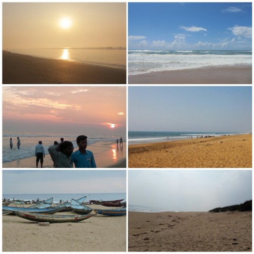
Located around three kilometers from the Sun Temple, this beach is one of the finest beaches in the east coast of India. Many cultural activities are held in this beach.
In June 2018, this beach became Asia’s first beach to get the Blue Flag certification — a tag given to environment-friendly clean beaches, equipped with amenities of international standards for tourists.
To achieve the Blue Flag standards, a beach has to strictly comply with 33 environment and tourism-related conditions. The standards were established by the Copenhagen-based Foundation for Environmental Education (FEE) in 1985.
— Arvind Nautiyal, project head of the Society for Integrated Coastal Management (SICOM)

Chandrabhaga Beach Images


Balukhand-Konark Wildlife Sanctuary

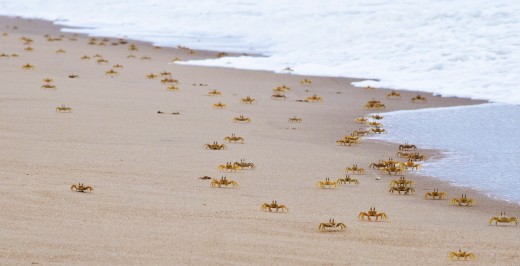
This wildlife sanctuary, which is in between Puri and Konark, covers an area of around 72 square kilometers. It extends from Banki Muhan near Puri to Keluni Muhan near Daluakani. Black buck is the star attraction in this sanctuary, which also houses other animals like spotted dear, stripped hyena, jungle cat and Olive Ridley sea turtles. Undulating sand dunes, lonely beaches, cashew plantations and casuarina groves in this area make it a memorable tourist destination.

Crabs at the Balukhand Reserve Forest beach


Wikimedia Commons
Wikimedia Commons

Ramchandi Beach

Ramchandi Beach is named after Goddess Ramchandi. This virgin beach is around seven kilometers from Konark sun temple. It is located on the convergence of the river Kusabhadra and the Bay of Bengal. This beautiful beach is well-known for its serene atmosphere and silvery sands.
Wonderful treat to the eyes, the river meets the sea, just about here! The temple is not far away, a visit to the shire and learning the history makes for a great experience.
— Raja M

Ramchandi Beach Distance from Bhubaneswar

82 kilometers

Konarak ASI museum

Located just outside the Sun Temple, this museum houses 250 different kinds of antiques.

Kuruma Buddhist Monastery.

Known for proffering a great insight to the Buddhism culture of Odisha, this monastery is located 8.6 kms to the south-east of the Sun Temple.

Konark Dance Festival

This 5-day annual dance festival is held in December, usually between 1 and 5, in the backdrop of the Sun temple.
Started in the year 1986 at Konark Natya Mandap by Padmashree Guru Gangadhar Pradhan, this festival is the harbinger of the contemporary festivals of Orissa.

International Sand Art Festival

International Sand Art Festival is an annual cultural event organized by the Orissa Tourism Department. It is held on the Chandrabhaga beach.

Safety Tips

Follow rules. For instance if you are asked not to swim in a particular beach, do not swim. Avoid poorly lit streets, deserted areas and narrow alleys after sunset. Do not get into unnecessary arguments with strangers, especially on sensitive topics like culture, religion, language, etc.

Thursday, January 9, 2020

12 Beautiful Hill Stations in Karnataka

Hill stations in Karnataka attract tourists from all over the world because they offer something or the other for people belonging to all age groups. Here is a brief overview of some of them.


Agumbe

Located in Shimoga district, on a plateau on top of Someshwara Ghat, Agumbe is surrounded by rich biodiversity. It is well-known for its serenity and scenic beauty. Hiking through the hills of Agumbe is an "out of this world" experience.
Agumbe Weather
Agumbe has the sobriquet "Cherrapunji of South India" because it receives 7,640 mm of mean annual rainfall, the second highest annual rainfall in India. Cherrapunji receives 11,777 mm.
Agumbe does not have varied temperature like the rest of the western ghat region since it is close to the coast.
It has a cool and pleasant climate for most parts of the year. The summer season, which lasts through March April and May, is quite dry and hot.
The temperature varies around the range of 30 to 35° Celsius and is not the most advisable time to visit the place for tourists who are from more temperate zones.
The winter season, which starts late December and lasts till February, is pleasant and mild. The temperature goes as low as 18° Celsius and the weather is pleasantly cold.
The monsoon season lasts from June to September and receives heavy rainfall. It is not a good time to visit Agumbe.

Agumbe


Wikimedia Commons
Wikimedia Commons | Source
To travel is to discover that everyone is wrong about other countries.
— Aldous Huxley

Madikeri

Madikeri, the district headquarters of Kodagu district, is a beautiful hill station town. Kodagu district is known as the Scotland of India. Madikeri is nestled amid the emerald mountains of the Western Ghats.

Best Time to Visit Madikeri

Plan a trip to this hill station between November and March.

Madikeri Weather

Madikeri features a tropical highland climate. The mean daily minimum temperature is lowest in January at about 11 °C. Maximum temperature in summer is around 24 °C to 27 °C.
With the onset of the south-west monsoon, the temperature decreases in June and the weather becomes chilly. The lowest temperature recorded is 4.5 °C.

Nandi Hills

This picturesque, serene and popular hill station is located in Chikkaballapur district. You will enjoy the misty mountains and the brilliant sunrise here.
Amruth Sarovar, Tippu's Summer Palace and Fort, Gavi Veerabhadra Swamy Temple, Horse Way, Palar River Origin, Brahmashrama, Yoga Nandeeshwara Temple, Tippu Drop, Arkavathi River Origin, Secret Passage, Children's play ground, Anjaneya temple, Nellikayi Basavanna, Antaragange, Baananthi Bande and Bhoga Nandeeshwara temple are some tourist attractions in Nandi Hills.

Nandi Hills Timings

6.00 am to 10.00 pm.
Traveling- it leaves you speechless, then turns you into a storyteller.
— Ibn Battuta

Kemmannugundi

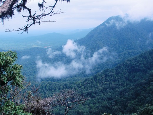
Located in Chikkamagaluru district, Kemmannugundi means a place with red soil. This scenic hill station is 1,434 meters above sea level. It attracts wild life enthusiasts and trekkers from all over the world.
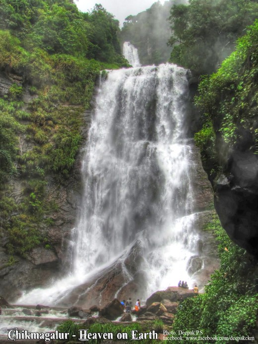
Hebbe Falls, Z Point, Kalhatti Falls, Shiva Temple, Mullayanagiri, Rajendra Hill, Rock Garden and Shanti Falls are major tourist attractions in Kemmannugundi.
A
Kemmangundi:
Kemmannugundi, Manchethevaru, Karnataka 577129, India
get directions

Hebbe Falls Near Kemmannugundi


Wikimedia Commons
Wikimedia Commons | Source
Twenty years from now you will be more disappointed by the things you didn’t do than by the ones you did do. So throw off the bowlines, sail away from the safe harbor. Catch the trade winds in your sails. Explore. Dream. Discover.
— Mark Twain

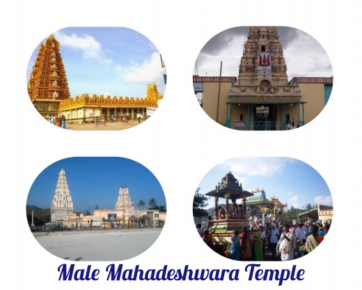
Male Mahadeshwara Betta

Located in Chamarajanagara district, this hill station is also a pilgrim town; it is popularly known as MM Hills. The main temple in the town is dedicated to Shri Male Mahadeshwara Swamy.

Male Mahadeshwara Temple Photos


Biligirirangana Hills

Popularly known as BR Hills, this beautiful hill station is located in Southeast Karnataka. Covering an area of 540 square kilometres, this breathtaking tourist attraction houses different species of flora and fauna.
A
BR Hills:
BR Hills Bus Stop, B R Hills, Karnataka 571117, India
get directions
Don’t tell me how educated you are. Tell me how far you’ve travelled.
— Mohammad

Gangamoola

Located in Chikkamagaluru district, this hill station is the birth place of River Tunga, River Bhadra and River Netravati. Temple of Goddess Bhagavathi and a 1.8 m Varaha image inside a cave are among the main tourist attractions of this place.
A
Gangamoola:
Kalasa Main Rd, Karnataka 577142, India
get directions

Gangamoola Weather

On an average Gangamoola records a rainfall of approximately 575 centimeters. Temperature ranges between 10°C and 35°C.

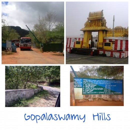
Gopalaswamy Hills

Located in Chamarajanagar district, this scenic hill station (1450m) is covered with mist for most part of the year. It is in Bandipur National Park. The hill station gets its name from the Gopalaswamy temple which is located here.
A
Gopalaswamy Hills:
Chamarajanagar, Gopalswami Hills, Karnataka 571126, India
get directions

Himavad Gopalaswamy Betta Images


Kundadri

Located in Shimoga district, Kundadri is a great place for trekking and for viewing sunrise and sunset.
A
Kundadri:
Kundadri, Changaru, Karnataka 577424
get directions

Yana

Yana is a small and quiet hill station located in Utttara Kannada district, in the Sahyadri mountain range of the Western Ghats. It is well-known for its two black crystalline limestone formations.
A
Yana:
Yana, Karnataka 581403, India
get directions

Yana Video

Kodachadri

This mountain peak is located in Western Ghats, in the middle of the Mookambika Wildlife Sanctuary. It is the highest peak in Shimoga district. It has been marked as a natural heritage site by the Government of Karnataka.
A
Kodachadri:
Kodachadri Hill, Valur, Karnataka 577452
get directions

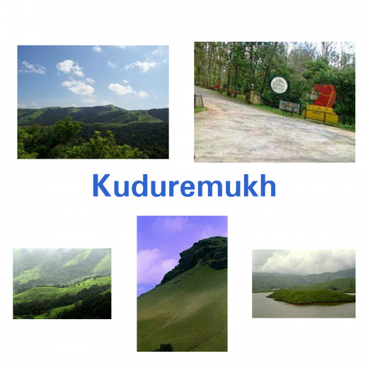
Kudremukh

Kudremukh literally means ‘horse’s face’. This place gets its name from one peak that resembles the face of a horse. Located in Chikkamagaluru district, this mountain range is a paradise for nature lovers, especially trekkers. It is at around 1894 meters above sea level. Its biodiversity attracts tourists from all parts of the world.
A
Kudremukh:
Kuduremukha, Karnataka, India
get directions

Kudremukh National Park Images


What to Pack for a Trip to Hill Station

Sl No
Essentials
1
Advance booking
2
Cold weather clothing
3
Shoes
4
Medicines
5
Skin care items

5 Major Cities in Karnataka

Sl No
City
1
Bengaluru
2
Mysuru
3
Hubballi-Dharwad
4
Mangaluru
5
Belgaum